Council Draft LEP Height Controls for HNSW areas of Redfern & Waterloo

This Height map for the HNSW Planning Master Plan area has been extracted from the Draft Local Environment Plan (LEP) that City of Sydney put to the Department of Planning for Approval and Exhibition in September 2010. This map is provided for easy comparison of the council’s proposed controls with the alternative controls produced by … Read more
HNSW Master Planning Approach Chart – June 2010

This is the chart that formed part of the HNSW Newsletters to Redfern and Waterloo tenants on 28 June 2010 explaining how the Federally funded Master Planning Process is expected to work alongside the RWA’s proposed Built Environment Plan Phase 2 (BEP2). Download: Master Plannig Approach – chart FINAL.pdf »

Overall View from Walker – Philip Streets

This diagram was released by the DoH on 9 January 2008 when the Minister announced that work would commence on the redevelopment of Walker and Elizabeth Street DoH properties. PDF 2MB. Download: Overall from Walker-Phillip Corner.jpg »

Aerial view from Walker – Philip Corner

This diagram was released by the DoH on 9 January 2008 when the Minister announced that work would commence on the redevelopment of Walker and Elizabeth Street DoH properties. PDF 3.9MB. Download: Aerial from Walker-Phillip Corner.JPG »

Chamber of Commerce meets with Housing Minister – 20 Nov 2007

On Tuesday 20th November the Redfern Waterloo Chamber of Commerce met with Matt Brown the NSW Minister for Housing. The following Briefing Note was released following the meeting. The Briefing Note details some of the Chamber’s concerns about issues which need to be adressed by the Department in Redfern Waterloo. File is 32KB PDF. Download: … Read more

Artists Impression 2

Artists Impression 2

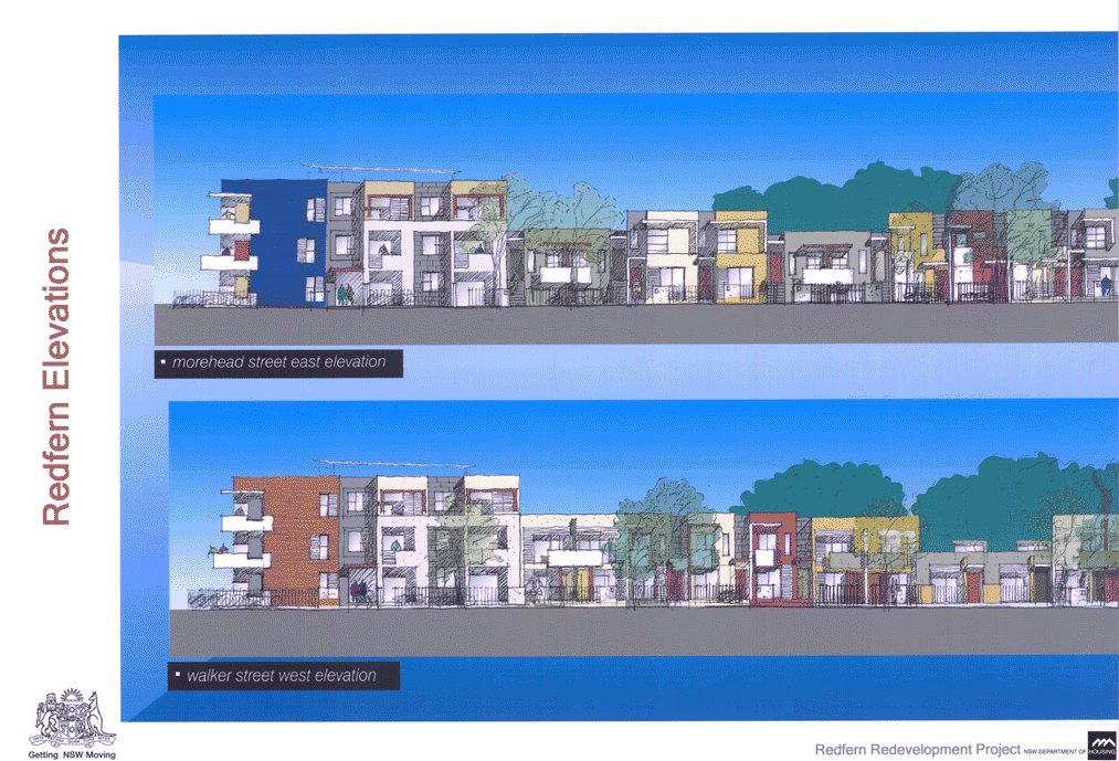
This is the second artist’s impression which shows Morehead Street East Elevation and Walker Street West Elevation (GIF 166Kb).

Artists Impression 1

Artists Impression 1

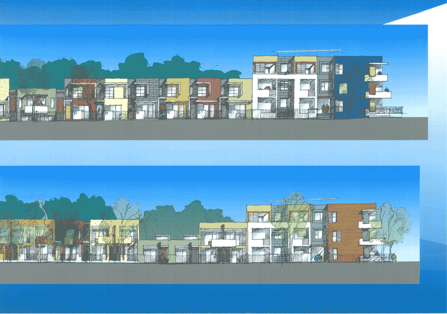
This is the first artist’s impression of the development bounded by Morehead and Walker streets (GIF 115Kb).

Area covered by Redevelopment

Area covered by Redevelopment

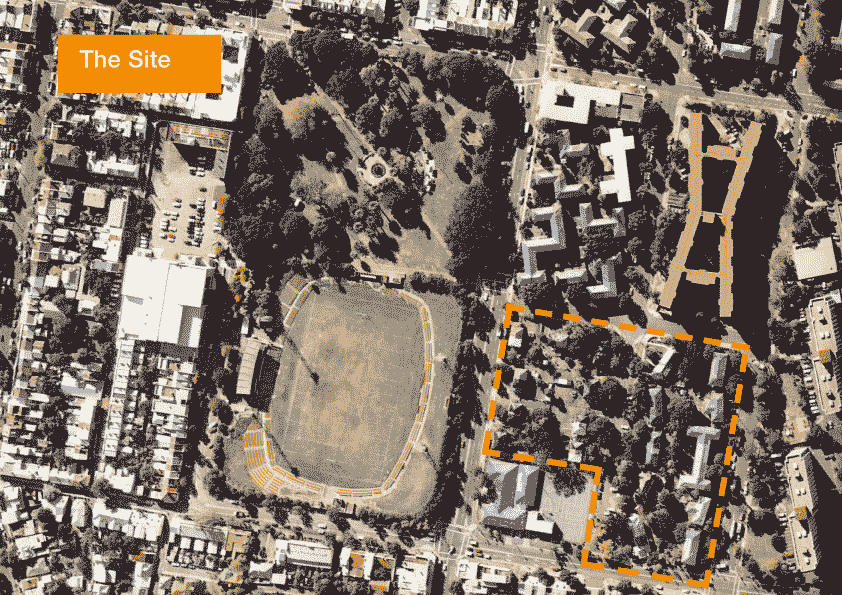
This map shows the area covered by the Department of housing re-development bordered by Elizabeth St, Phillip Street, Morehead street and Kettle Street (GIF 106Kb).

Building Type in Waterloo & Redfern Urban Design Study Area

This map shows building type in the Waterloo & Redfern Urban Design Study Area and hence helps to identify the range of buildings held by the Department of Housing in the Waterloo & Redfern area. PDF 379 Kb. Download: RWUD Building Type.pdf »

Heritage Map from Waterloo & Redfern Urban Design Study

This is the Heritage map from the Waterloo & Redfern Urban Design Study. It show some of the issues facing DoH if it wished to consolidation its land holdings in the “Elizabeth Street” Urban Design Study area. PDF 360 Kb. Download: RWUD Heritage.pdf »

DoH Redevelopment Opportunity Example

The City of Sydney Urban Design Study takes the towers on Phillip Street Waterloo as an example of how the site could be redeveloped to provide higher density and eventually remove the towers. It proposes reopening George Street and turning current public open space into more housing and private open space for tenants. File is … Read more

Waterloo Mixed DoH – Elizabeth Street in the Urban Design Study

This is the extract covering the DoH properties in Waterloo that are largely unconsolidated in the area generally boundered by Pitt, Phillip, Morehead and McEvoy Streets. This area has a number of heritage features which are shown on the heritage map. PDF 1.8 MB. Download: RWUD Elizabeth Street.pdf »

DoH Properties in Waterloo & Redfern Urban Design Area

This map was produced at the end of the consultation process as a result of requests from the community. The map shows the location of Department of Housing properties in Waterloo & Redfern Urban Design Area. PDF 278Kb. Download: AppendixE.pdf »

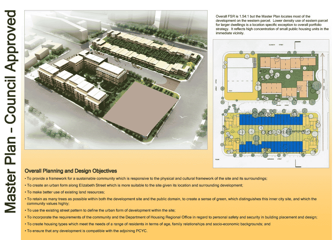
Elizabeth St Masterplan 3D

This is a 3D version of the current / initial Master Plan. The Master plan has not been changed following the Department of Housings email to residents in May 2005 that they would put the project up for expressions of interest with the previously excluded PCYC included. Download: Eliz St Masterplan 3D image.jpg »