Overshadowing Drawings for Waterloo (South) Planning Proposal
The Overshadowing Drawings for the Waterloo (South) Planning Proposal are only found in the Appendix B of the Addendum to urban design report by Hassell. To enable easy access to these drawings that give information of the shadows at different times of the day mid winter and mid summer and at the Equinox, we have… Read More…
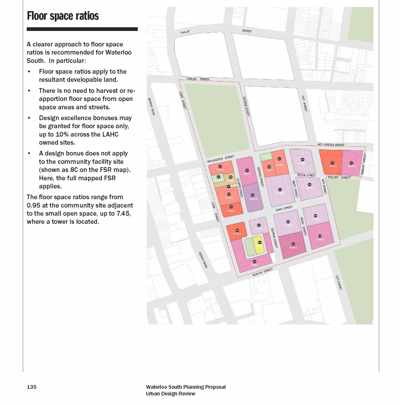
Floor Space Ratios (FSRs) for Waterloo South Planning Proposal

The main Planning Proposal document does not contain the proposed Floor space rations (FSRs) proposed. The FSR map can be found on page 135 of the Hassell Addendum to the urban design report or spread across two pages of the draft LEP Cadastre maps. We have extracted the FSR map from the Hassell Addendum to… Read More…

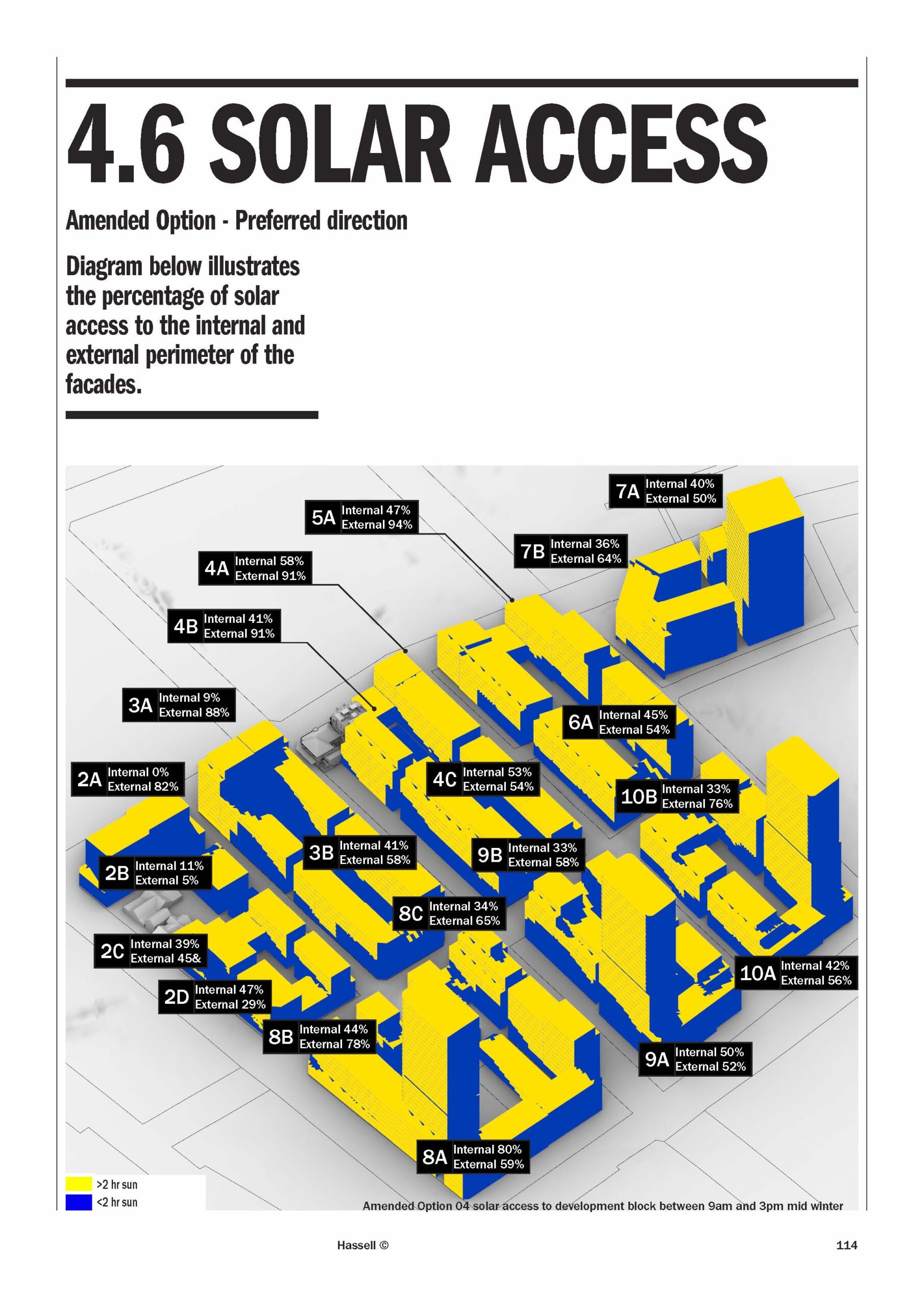
Solar Access for buildings in the Waterloo South Project Proposal

This diagram illustrates the percentage of solar access to the internal and external perimeter of the building facades for each development block in the Waterloo (South) planning proposal between 9am and 3pm mid winter. Yellow shows greater than 2 hours sun and blue shows less than 2 hours sun. It it from page 114 of… Read More…

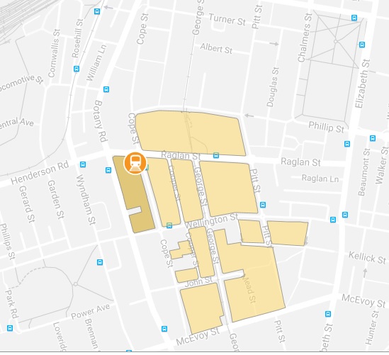
Map of Waterloo Estate and Metro Station showing private land

This map is has been shown on the Waterloo page of UrbanGrowth’s Central to Eveleigh website. It shows the area of public housing subject to redevelopment as well as the area resumed for the new Metro Station development. Areas along Wellington Street and Cope Street between Wellington and John Streets are not shown as part… Read More…