Waterloo South proposed Land Use Zoning Map
This map shows the Waterloo South proposed Land Use Zoning Map with the proposed zones. Permissible uses under each zone are shown in the article.
Redfern, Eveleigh, Darlington, Waterloo Watch
This map shows the Waterloo South proposed Land Use Zoning Map with the proposed zones. Permissible uses under each zone are shown in the article.
Below are the consultation and capacity building details for the Waterloo South Planning Proposal. We will update this as more information comes to hand. Read More…
Height of buildings is basic to understanding a planning proposal. This planning proposal makes understanding height difficult by dealing with it in a number of ways. Also height maps in the documents do not always agree. Here REDWatch unpacks the Height of buildings in the Waterloo South planning p Read More…
The Overshadowing Drawings for the Waterloo (South) Planning Proposal are only found in the Appendix B of the Addendum to urban design report by Hassell. To enable easy access to these drawings that give information of the shadows at different times of the day mid winter and mid summer and at the Equinox, we have … Read more
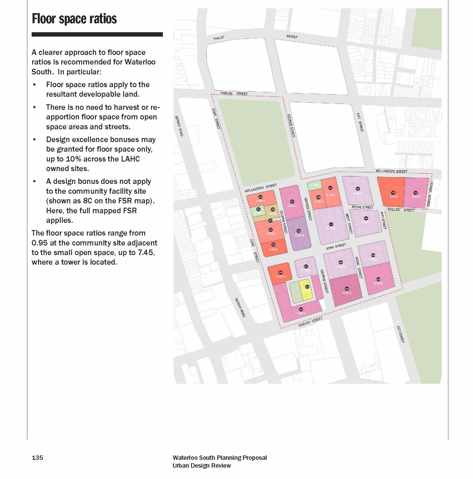
The main Planning Proposal document does not contain the proposed Floor space rations (FSRs) proposed. The FSR map can be found on page 135 of the Hassell Addendum to the urban design report or spread across two pages of the draft LEP Cadastre maps. We have extracted the FSR map from the Hassell Addendum to … Read more
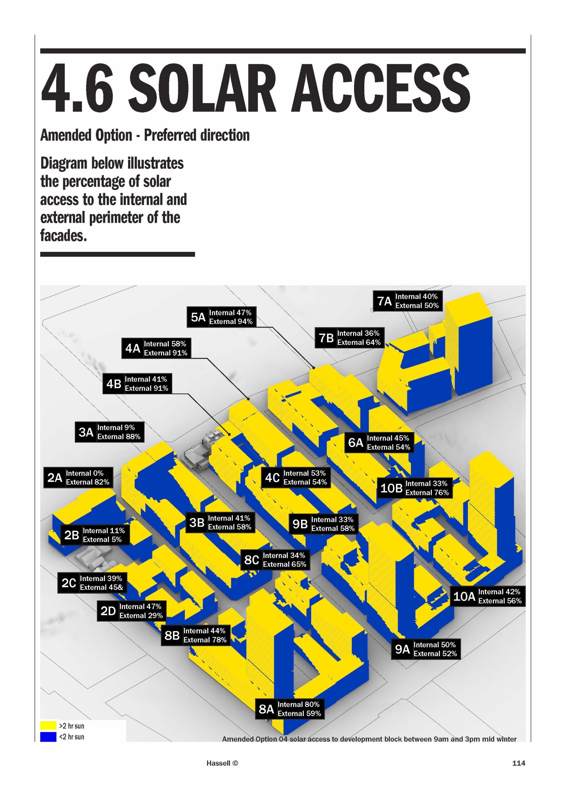
This diagram illustrates the percentage of solar access to the internal and external perimeter of the building facades for each development block in the Waterloo (South) planning proposal between 9am and 3pm mid winter. Yellow shows greater than 2 hours sun and blue shows less than 2 hours sun. It it from page 114 of … Read more
REDWatch has created this easy access version of Waterloo South planning proposal maps. For each of the draft controls to go into the City of Sydney Local environment Plan there are two pages because the join between two of the pages runs through the north western tip of Waterloo South. REDWatch has created this pdf … Read more
The Waterloo South planning proposal documents are complex because they contain documents relating to the original LAHC proposal, Council’s proposal, the Gateway determination and then the subsequent additional studies produced by the Planning Proposal Authority that was not Council. They are also c Read More…
The Waterloo South planning proposal proposes changing land uses the existing residential R1 and 2b zones to RE1, and business zones B2 and B4 for the area. The B4 zone is mitigated by applying in the LEP a Restricted Retail Development over this area which limits shops to 1,000 square metres. The L Read More…
This is the text of the media release from Minister for Planning and Minister for Homes Anthony Roberts regarding the Waterloo Estate (South) public exhibition on 3 March 2022. Read More…