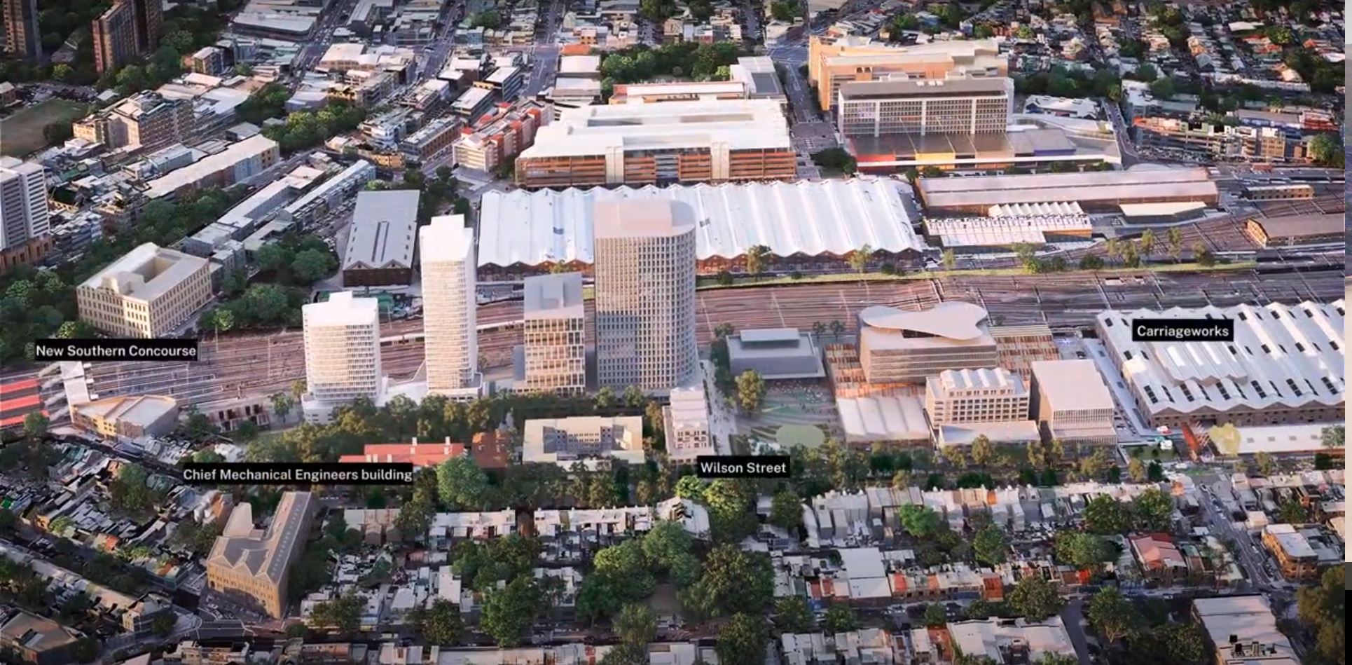
The Paint Shop Precinct Proposed Land Use Map
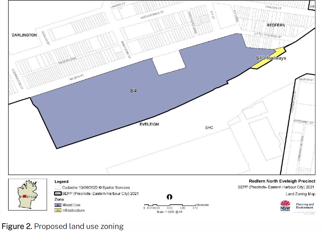
Probably because of the decision to place FSR across the entire site the whole of the site is zoned as mixed use in the land use map. As a consequence the 20+% of the site that are public areas are not protected as recreational zones, which makes it possible to change controls later without having… Read More…
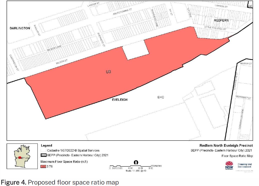
The Paint Shop Precinct Proposed Floor Space Ratio (FSR) Map

This is an interesting map because it allocates 2.78 times the area across the entire site rather than to the proposed buildings. So the roads, walkways and public spaces all have the allocated FSR. The proposal uses a lower level planning document, the design guide, to say where that floor space should go rather than… Read More…

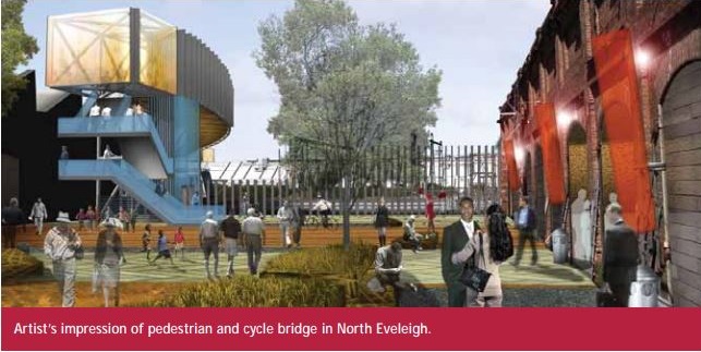
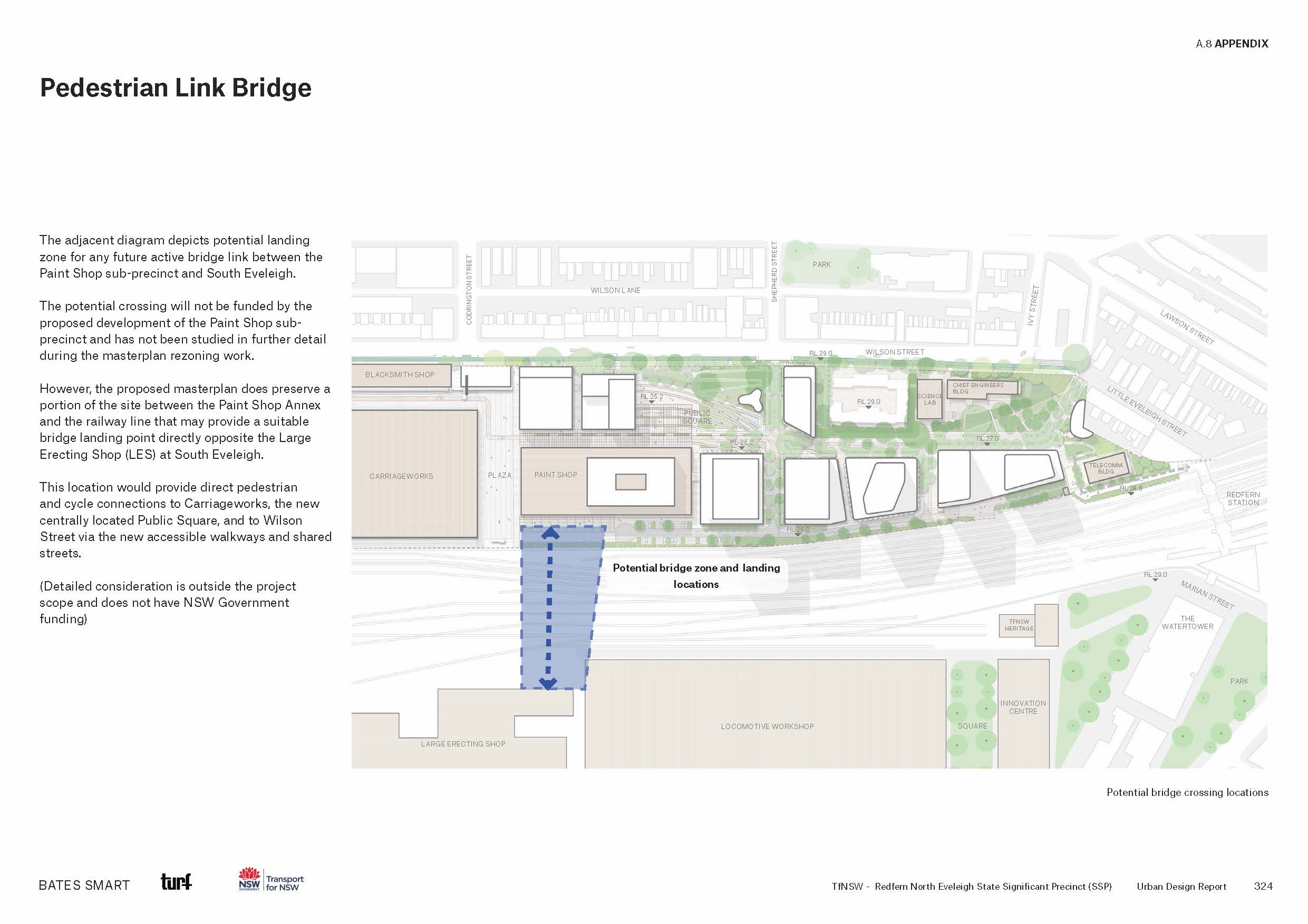
Eveleigh Link Bridge – North Eveleigh Bates Smart Page 324

In the Urban Design Study there is the single page assessment of a pedestrian link bridge between North and South Eveleigh. The last sentence below says: (Detailed consideration is outside the project scope and does not have NSW Government funding). Interestingly in the Large Erecting Shop (LES) rezoning by TAHE / TfNSW / Mirvac where… Read More…

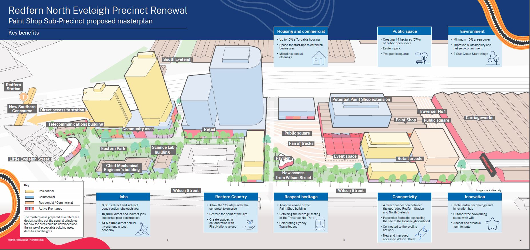
Outline of the Paint Shop Precinct Masterplan

This outline can be found in the Transport for NSW newsletter. It gives an overview of what is being proposed for the site under the masterplan reflected in the rezoning planning proposal on exhibition until 25 August 2022.

Social Impacts in Waterloo South!

The discussion about the need for a Social Impact Study for Waterloo (South) has inspired Geoffrey Atherden to produce this great cartoon on social impacts and why they might catch you unaware. Image Copyright © Geoffrey Atherden.

Overshadowing Drawings for Waterloo (South) Planning Proposal

The Overshadowing Drawings for the Waterloo (South) Planning Proposal are only found in the Appendix B of the Addendum to urban design report by Hassell. To enable easy access to these drawings that give information of the shadows at different times of the day mid winter and mid summer and at the Equinox, we have… Read More…

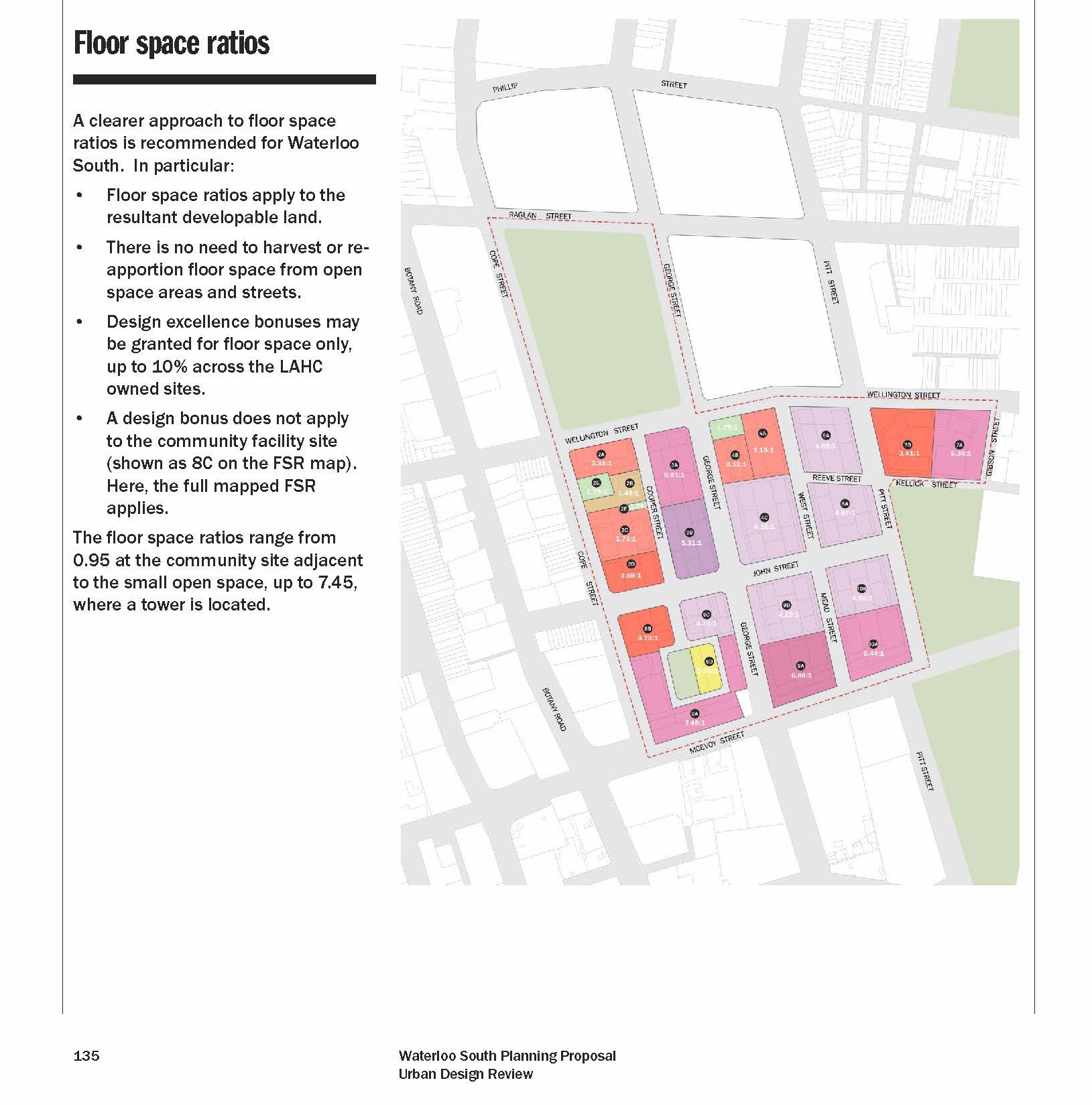
Floor Space Ratios (FSRs) for Waterloo South Planning Proposal

The main Planning Proposal document does not contain the proposed Floor space rations (FSRs) proposed. The FSR map can be found on page 135 of the Hassell Addendum to the urban design report or spread across two pages of the draft LEP Cadastre maps. We have extracted the FSR map from the Hassell Addendum to… Read More…

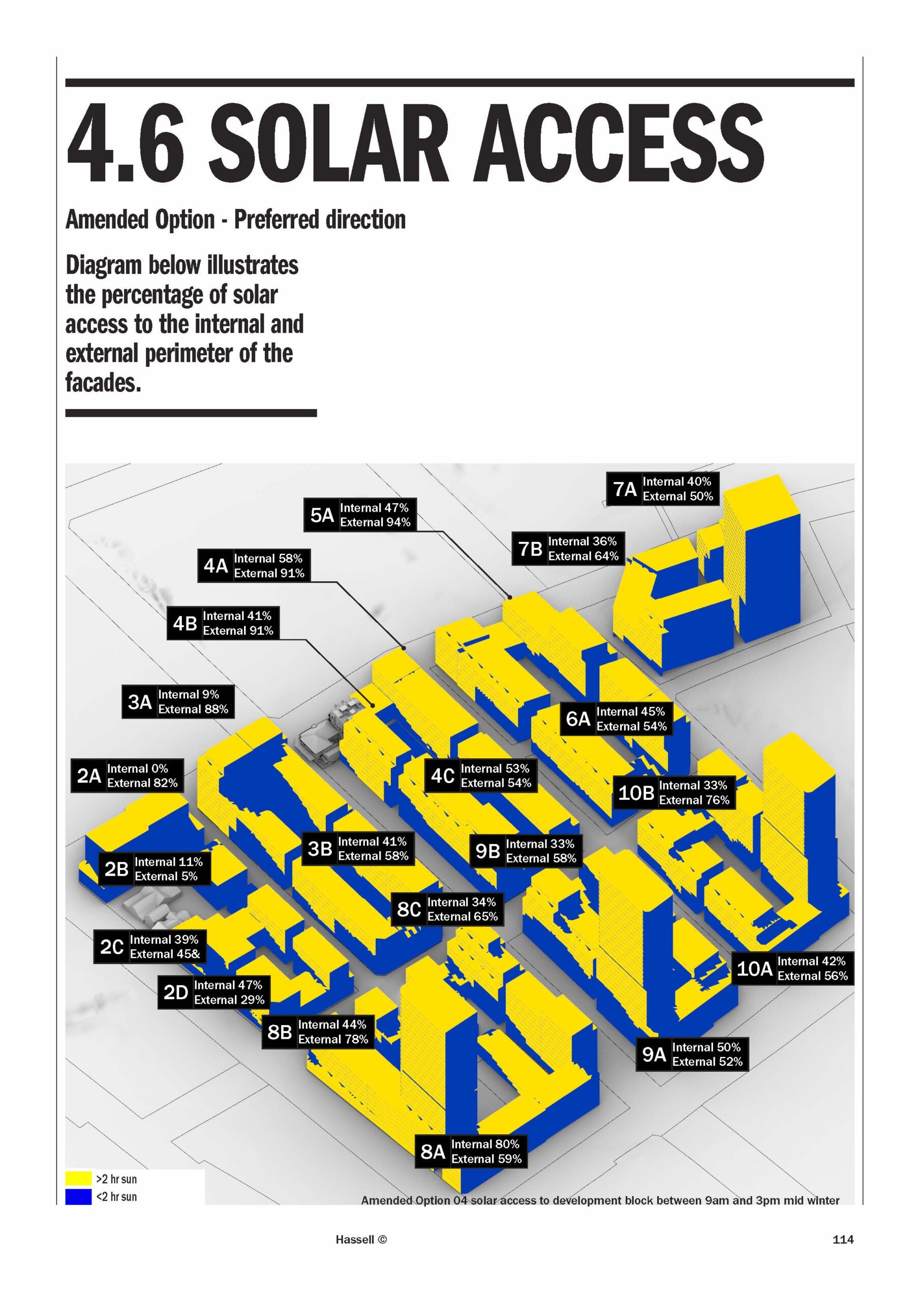
Solar Access for buildings in the Waterloo South Project Proposal

This diagram illustrates the percentage of solar access to the internal and external perimeter of the building facades for each development block in the Waterloo (South) planning proposal between 9am and 3pm mid winter. Yellow shows greater than 2 hours sun and blue shows less than 2 hours sun. It it from page 114 of… Read More…